
E-Catalogue
NP286.2
-
LIST OF RADIO SIGNALS
-
TITLE: Vol 6 (2) Port Services, VTS &Port Ops – Europe, Arctic and Baltic Coasts, including Iceland and Faroe Islands (Gp 1) Covered partially by ADRS6 Licence Areas 1 & 2 and 3
-
EDITION : 4th, 2023
-
PUBLISHER: UKHO
-
LANGUAGE: ENGLISH
-
IMPA CODE: 370636
NP286.3
-
LIST OF RADIO SIGNALS
-
TITLE: Vol 6 (3) Pilot Services, VTS & Port Ops – Mediterranean Sea, Black Sea, Caspian Sea and Suez Canal (Gp 1) Covered partially by ADRS6 Licence Areas 1 & 2, 3, 4, 5 and 10
-
EDITION : 4th, 2023
-
PUBLISHER: UKHO
-
LANGUAGE: ENGLISH
-
IMPA CODE: 370637

NP286.4
-
LIST OF RADIO SIGNALS
-
TITLE: Vol 6 (4) Pilot Services, VTS & Port Ops – Indian sub-continent, South East Asia and Australasia (Gp 1) Covered partially by ADRS6 Licence Areas 5, 6, 7, 8 and 10
-
EDITION : 4th, 2023
-
PUBLISHER: UKHO
-
LANGUAGE: ENGLISH
-
IMPA CODE: 370638
NP286.5
-
LIST OF RADIO SIGNALS
-
TITLE: Vol 6 (5) Pilot Services, VTS & Port Ops – N America, Canada and Greenland (Gp 1) Covered partially by ADRS6 Licence Areas 1 & 2, 3, 9 and 8
-
EDITION : 4th, 2023
-
PUBLISHER: UKHO
-
LANGUAGE: ENGLISH
-
IMPA CODE: 370639
NP286.6
-
LIST OF RADIO SIGNALS
-
TITLE: Vol 6 (6) Pilot Services, VTS & Port Ops – North East Asia and Russia (Pacific Coast) (Gp 1) Covered partially by ADRS6 Licence Areas 3, 5, 6 and 8
-
EDITION : 5th, 2024
-
PUBLISHER: UKHO
-
LANGUAGE: ENGLISH
-
IMPA CODE: 370646
NP286.7
-
LIST OF RADIO SIGNALS
-
TITLE: Vol 6 (7) Pilot Services, VTS & Port Ops – Central and South America and the Caribbean (Gp 1) Covered partially by ADRS6 Licence Areas 8, 9 and 10
-
EDITION : 5th, 2024
-
PUBLISHER: UKHO
-
LANGUAGE: ENGLISH
-
IMPA CODE: 370647
NP286.8
-
LIST OF RADIO SIGNALS
-
TITLE: Vol 6 (8) Pilot Services, VTS & Port Ops – Africa (excluding Mediterranean Coast) , Red Sea and the Persian Gulf (Gp 1) Covered partially by ADRS6 Licence Areas 4 (potentially), 5 and 10
-
EDITION : 5th, 2024
-
PUBLISHER: UKHO
-
LANGUAGE: ENGLISH
NP294
-
HOW TO KEEP YOUR ADMIRALTY PRODUCTS UP TO DATE
-
TITLE: The publication gives in detail and with instructive examples information on the correct way of maintaining the chart stock.
-
EDITION : 11th, 2022
-
PUBLISHER: UKHO
-
LANGUAGE: ENGLISH
-
IMPA CODE: 371739
NP3
-
SAILING DIRECTION
-
TITLE: AFRICA PILOT VOL 3
-
EDITION : 18th, 2019
-
AUTHOR: UKHO
-
LANGUAGE: ENGLISH
-
IMPA CODE: 370923
-
This edition of Africa Pilot Vol. III (NP 3) in the British Admiralty Sailing Directions series. It covers the South and East Coasts of Africa from Cape Agulhas to Ras Binnah, including the islands of Zanaibar and Pemba.

NP30
-
SAILING DIRECTION
-
TITLE: China Sea Pilot Vol 1
-
EDITION : 13th, 2024
-
PUBLISHER: UKHO
-
LANGUAGE: ENGLISH
-
IMPA CODE: 370949
-
China Sea Pilot Vol. I (NP 30) in the British Admiralty Sailing Directions series. It covers the West Side of South China Sea from Tanjung Lompat on the Eastern Side of Peninsula Malaysia to Zheland Yan in China, Pulau-Pulau Anambas, Hainan Dao, and the islands and banks bordering the main route from Singapore Strait to Hong Kong.
NP303.1
-
RAPID SIGHT REDUCTION TABLES
-
TITLE: Available as a three volume set. Volume 1 is aimed at the navigator using astro-navigation and provides the optimum selection of stars for a three-star fix. Volume 2 covers latitudes between 0° and 40°, with Volume 3 covering latitudes between 39° and 89°.
-
EDITION : 4th,2023
-
PUBLISHER: UKHO
-
LANGUAGE: ENGLISH
-
IMPA CODE: 371760
NP303.2
-
RAPID SIGHT REDUCTION TABLES
-
TITLE: Available as a three volume set. Volume 1 is aimed at the navigator using astro-navigation and provides the optimum selection of stars for a three-star fix. Volume 2 covers latitudes between 0° and 40°, with Volume 3 covering latitudes between 39° and 89°.
-
EDITION : 2018
-
PUBLISHER: UKHO
-
LANGUAGE: ENGLISH
-
IMPA CODE: 371761
NP303.3
-
RAPID SIGHT REDUCTION TABLES
-
TITLE: Available as a three volume set. Volume 1 is aimed at the navigator using astro-navigation and provides the optimum selection of stars for a three-star fix. Volume 2 covers latitudes between 0° and 40°, with Volume 3 covering latitudes between 39° and 89°.
-
EDITION : 2nd,2019
-
PUBLISHER: UKHO
-
LANGUAGE: ENGLISH
-
IMPA CODE: 371762
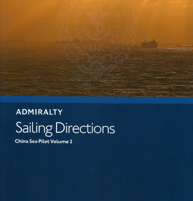
NP31
-
SAILING DIRECTION
-
TITLE: China Sea Pilot Vol 2
-
EDITION : 15th, 2022
-
PUBLISHER: UKHO
-
LANGUAGE: ENGLISH
-
IMPA CODE: 370950
-
The China Sea Pilot Volume 2 (NP31) covers the NW coast of Borneo, the Philippine Islands from Cape Buliluyan in Palawan to Cape Bojeador in Luzon, and the islands and dangers in the S and E parts of the South China Sea.
NP314
-
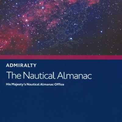
THE NAUTICAL ALMANAC
-
TITLE: Essential astronomical information for every kind of sea-going vessel, from cruise liners to fishing boats, this comprehensive almanac contains a set of concise sight reduction tables for the navigator, together with all the necessary information needed for use in determining the position at sea from sextant observations. This book has been jointly prepared by HM Nautical Almanac Office and the Nautical Almanac Office at the United States Naval Observatory, to meet the requirements of the Royal Navy and the US Navy.
-
EDITION : 24th,2024
-
PUBLISHER: UKHO
-
LANGUAGE: ENGLISH
-
IMPA CODE: 370661
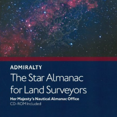
NP321
-
THE STAR ALMANAC FOR LAND SURVEYORS
-
TITLE: The Star Almanac contains positions of the major and selected bright stars in a tabular format for easy identification. It is ideal for land surveyors who use astronomical observations to determine their geographical position or the direction to true north.
-
EDITION : 1st,2023
-
PUBLISHER: UKHO
-
LANGUAGE: ENGLISH
-
IMPA CODE: 371747
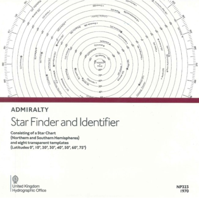
NP323
-
STAR FINDER AND IDENTIFIER
-
The ADMIRALTY Star Finder and Identifier consists of star charts for the northern and southern hemisphere together with 8 transparent templates for latitudes 0, 10, 20, 30, 40, 50, 60, 75 degrees. The chart shows 57 stars tabulated in The Nautical Almanac (NP314)TITLE: Available as a three volume set. Volume 1 is aimed at the navigator using astro-navigation and provides the optimum selection of stars for a three-star fix. Volume 2 covers latitudes between 0° and 40°, with Volume 3 covering latitudes between 39° and 89°.
-
EDITION : 1974
-
PUBLISHER: UKHO
-
LANGUAGE: ENGLISH
-
IMPA CODE: 370673
NP32A
-
SAILING DIRECTION
-
TITLE: China Sea Pilot Vol 3
-
EDITION : 5th, 2024
-
PUBLISHER: UKHO
-
LANGUAGE: ENGLISH
-
IMPA CODE: 370951
-
China Sea Pilot Vol. III (NP 32A) in the British Admiralty Sailing Directions series. It covers the Coast of China from Zhelang Yan to Yalu Jiang or Amnok Kang, North Coast of Luzan, north coasts of Taiwan and the West Coast of Korea
NP32B
-
SAILING DIRECTION
-
TITLE: China Sea Pilot Vol 4
-
EDITION : 4th, 2022
-
PUBLISHER: UKHO
-
LANGUAGE: ENGLISH
-
IMPA CODE: 370951
-
The China Sea Pilot volume 4 Covers the coast of: China from Zhelang Jiao to Yalu Jiang or Amnok Kang, N coast of Luzon, coasts of Taiwan and W coast of Korea.
NP33
-
SAILING DIRECTION
-
TITLE: Philippine Islands Pilot 7
-
EDITION : 7th, 2021
-
PUBLISHER: UKHO
-
LANGUAGE: ENGLISH
-
IMPA CODE: 370952
-
This edition of Philippine Islands Pilot (NP 33) in the British Admiralty Sailing Directions series. It covers the Northern and Northeastern Coasts of Borneo to the Sabah-Indonesian border, the Philippine Islands (except for the western coasts of Palawan and Luzon, between Cape Buliluyan and Cape Bojeador and Siniguian Point), Sulu Sea and Sulu Archipelago.
NP34
-
SAILING DIRECTION
-
TITLE: Indonesia Pilot Vol 2
-
EDITION : 10th, 2022
-
PUBLISHER: UKHO
-
LANGUAGE: ENGLISH
-
IMPA CODE: 370953
-
The Indonesia Pilot Volume 2 (NP34) covers the NS coast of Jawa E-wards from Tanjung Awarawar including Pulau Madura and Bali, Nusatenggara incl. Pulau Wetar and Kisar, S coast of Kalimantan E-wards from Tanjung Puting, E coast of Kalimantan as far N as the border with Sabah-Malaysia, Sulawesi, and the Wpart of Pulau-pulau Sula
NP35
-
SAILING DIRECTION
-
TITLE: Indonesia Pilot Vol 3
-
EDITION : 8th, 2021
-
PUBLISHER: UKHO
-
LANGUAGE: ENGLISH
-
IMPA CODE: 370954
-
The Indonesia Pilot Vol 3 (np35) Covers the Island of Timor and East Timor together with Pulau Rote, Islands of the eastern part of Ceram Sea including Buru and Seram, Molucca Sea including Halmahera, Islands between the north-east coast of Sulawesi and Mindanao, north coast of Papua westwards, including adjacent Islands.
NP350.1
-
DISTANCE TABLES
-
TITLE: VOL.1 / ATLANTIC OCEAN
-
EDITION : 2nd,2011
-
PUBLISHER: UKHO
-
LANGUAGE: ENGLISH
-
IMPA CODE: 370641
NP350.2
-
DISTANCE TABLES
-
TITLE: VOL.2 / INDIAN OCEAN
-
EDITION : 3rd,2008
-
PUBLISHER: UKHO
-
LANGUAGE: ENGLISH
-
IMPA CODE: 370643
NP350.3
-
DISTANCE TABLES
-
TITLE: VOL.3 / PACIFIC OCEAN
-
EDITION : 2nd,2009
-
PUBLISHER: UKHO
-
LANGUAGE: ENGLISH
-
IMPA CODE: 370644
NP36
-
SAILING DIRECTION
-
TITLE: Indonesia Pilot Vol 1
-
EDITION : 11th, 2021
-
PUBLISHER: UKHO
-
LANGUAGE: ENGLISH
-
IMPA CODE: 370955
-
Indonesia Pilot Vol. I (NP 36) in the British Admiralty Sailing Directions series. It covers the West Coast of Java, the North Coast of Java eastwards to Tanjung Bendoh, South and East Coasts of Sumatra, Selat Sunda, Selat Bangka, Selat Gelasa, south and west coasts of Kalimantan from Tanjung Puting to Pulau Pontianak, Pulau-Pulau Badas and Tambelan, Pulau-Pulau Lingga and Riau, with the various routes leading to Singapore and South China Sea.
NP37
-
SAILING DIRECTION
-
TITLE: West Coasts of England and Wales Pilot
-
EDITION : 21th, 2022
-
PUBLISHER: UKHO
-
LANGUAGE: ENGLISH
-
IMPA CODE: 370956
-
West Coasts of England and Wales Pilot (NP 37) in the British Admiralty Sailing Directions series. It covers the west coasts of England and Wales, and south coast of Scotland, from Cape Cornwall to Mull of Galloway including Isle of Man.
NP38
-
SAILING DIRECTION
-
TITLE: West Coast of India Pilot
-
EDITION : 20th, 2023
-
PUBLISHER: UKHO
-
LANGUAGE: ENGLISH
-
IMPA CODE: 370956
-
The West Coast of India Pilot (NP38) covers the Maldives, Lakshadweep, Sri Lanka with Palk Bay, the W coast of India and the coast of Pakistan.
NP39
-
SAILING DIRECTION
-
TITLE: South Indian Ocean Pilot
-
EDITION : 16th, 2020
-
PUBLISHER: UKHO
-
LANGUAGE: ENGLISH
-
IMPA CODE: 370958
-
The South Indian Ocean Pilot (NP39) covers the Comores, Madagascar, Seychelles group, La Reunion, Mauritius, Chagos Archipelago and other islands lying westward of 90 degr. E.
NP4
-
SAILING DIRECTION
-
TITLE: South-East Alaska Pilot
-
EDITION : 8th, 2015
-
PUBLISHER: UKHO
-
LANGUAGE: ENGLISH
-
IMPA CODE: 370924
-
This edition of South East Alaska Pilot (NP 4) in the British Admiralty Sailing Directions series. It covers the South East Coast of Alaska from Dixon Entrance to Cook Inlet..